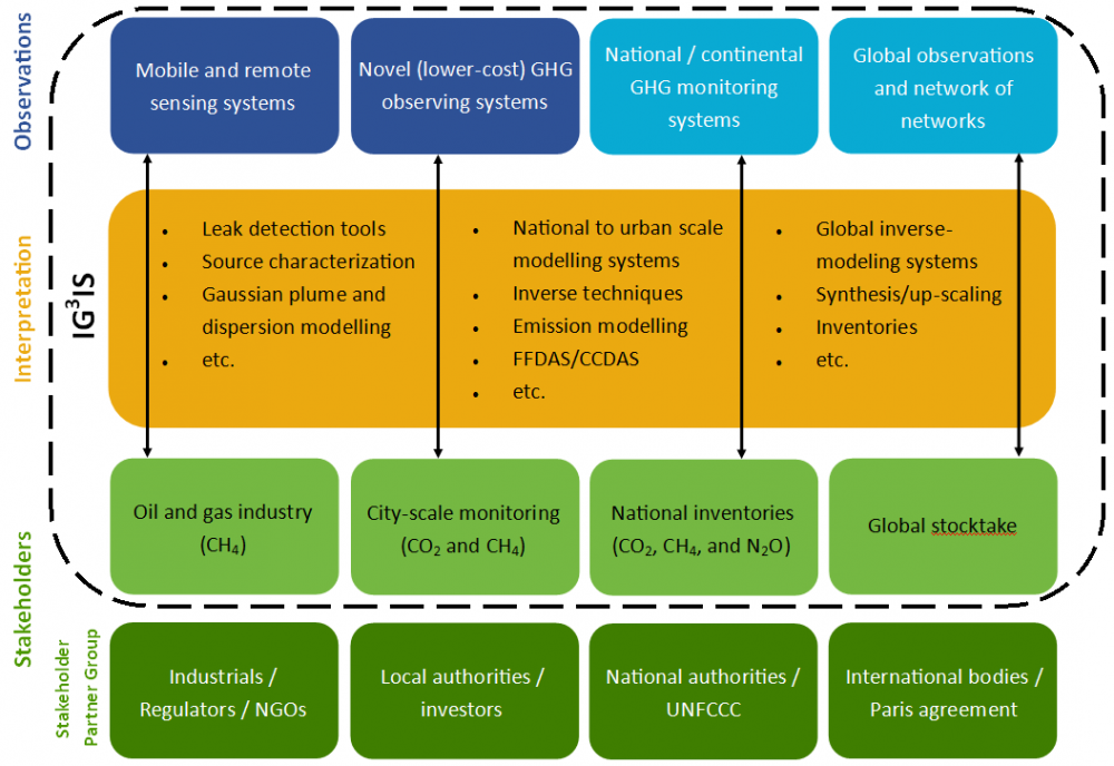
How the four objectives are accomplished can be seen in the figure below. The IG3IS framework incorporates the blue, yellow, and light green bubbles, showing the accumulation of observations, interpretation of those observations, and the delivery of results that are tailored to meet each of the four objectives. For example, mobile and remote sensing system data goes is analyzed with leak detection tools, is source characterized, and goes through Gaussian plume and dispersion modelling in order to identify methane leaks within the oil and gas industry. Throughout this process, the IG3IS team is working closely with stakeholder partner groups, in order to ensure that the results IG3IS produces is as useful to those stakeholders. Returning to the original example, fossil fuel industries, their regulators, and any non-governmental organizaitons (NGOs) that have a particular interest in methane leaks are contacted throughout the process so that IG3IS can produce useful data for each stakeholder with their varying goals.

Steps needed to ensure that these framework depicted above is applicable across the globe:
- Extend the international World Meteorological Organization (WMO) Global Atmosphere Watch (GAW) network of in situ sampling stations to fill in underrepresented regions globally, thereby improving national sampling of regional greenhouse gas emissions, and improve transport models to capture a small footprint on global scales
- Expand the international WMO GAW network to increase collection of vertical profiles of greenhouse gases would constrain atmospheric transport and facilitate interpretation of satellite data through commercial aircraft and balloons reaching higher altitudes
- Continue to improve transport through WMO efforts such as HIW and S2S
- Incorporate all major emitting nations and groups of neighboring smaller nations would participate in the cooperative network and in the modeling effort. This may require financial assistance and capacity building to aid the poorer nations that dominate the more undersampled regions.
